MKMUKOKO.STUDIOVISION LAB / 021
MANYAME R.D.C.DUNOTTAR
PLAN STUDYJULY 2025
PROPOSED HIGH-DENSITY SETTLEMENT / 612.32 HA

Dunottar. Made visible.

EXPLORE DUNOTTAR
EXPLORE THE LIVING CITY
START A TOUR
MODEL
FLY TO
Whole city · all districts
DistrictsStreets · on the city surfaceWayfinding · source planWayfinding · design concepts
0 forms · complete plan
Tap selects · Inspect moves closer
Drag to pan · two fingers to pan & zoom · tap selects
Preparing the future city…
LIVE WEBGL CITY · 0 PLAN-ANCHORED FORMS
Illustrative Dunottar green-city concept

THE CITY BEYOND THE DRAWING

A Zimbabwean city designed around everyday life.

Explore an evidence-bounded digital vision of Dunottar — from the whole city to districts, streets and individual plan-anchored stands.
9,580Residential stands
612.32 haTotal layout
43.63 haOpen space
12Primary & secondary school sites
ILLUSTRATIVE DIGITAL CITY · PLAN-ANCHORED DATA
HomesModern Zimbabwean living
Business & RetailTrade, work and opportunity
EducationLearning close to home
Green SpacesParks, buffers and landscape
CommunityHealth, sport and civic life
InvestmentEvidence before assumption
Illustrative Dunottar city concept overview

DIGITAL DEVELOPMENT TWIN

Explore Dunottar City

Move through the same place at City → District → Street → Property scale.
  • Plan-anchored numbered stands
  • Living 3D neighbourhood model
  • Evidence-aware civic and investment context
  • Property review handoff to Kumusha Homes
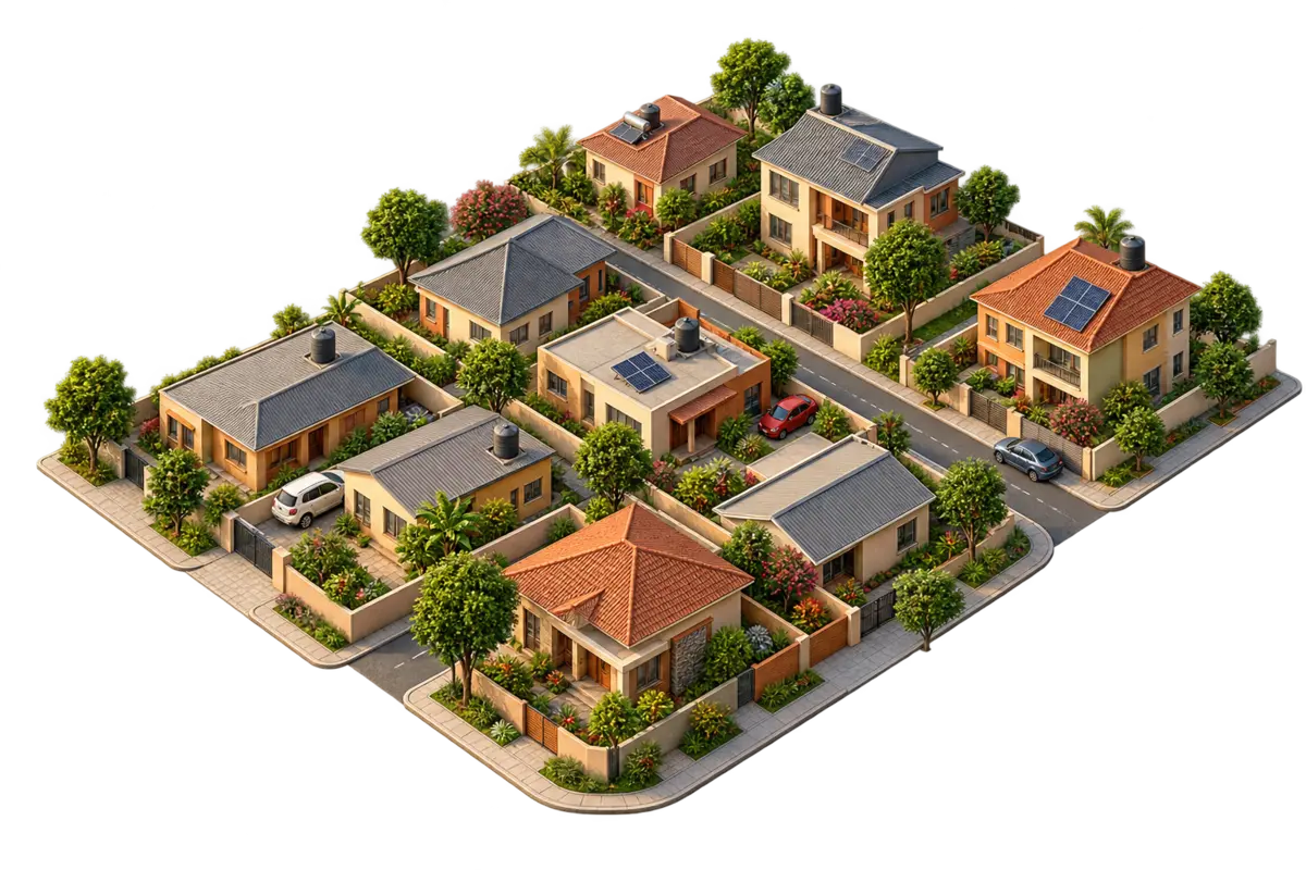
Illustrative Dunottar neighbourhood concept

DISCOVER THE VISION

Built around people, landscape and a recognisable Zimbabwean identity.

“A city model should make the relationships visible before it makes the claims.”— Mukoko.Studio spatial principle

LIVING

Featured neighbourhoods

Distinct character. One connected city.

INVESTMENT

Opportunity with evidence attached.

Explore the plan-derived opportunity families, source material and unresolved due-diligence questions without turning concept into fact.
9,580Residential standsPlan-derived
82Commercial sitesPlan-derived
81Industrial sitesPlan-derived
47Institutional sitesPlan-derived
58Flat sitesPlan-derived
21.91%Land allocated to roadsPlan-derived

CITY SYSTEMS

A sustainable future has to be visible at street level.

Green space, water resilience, movement and energy are presented as connected city systems. Concept imagery is clearly separated from verified delivery status.
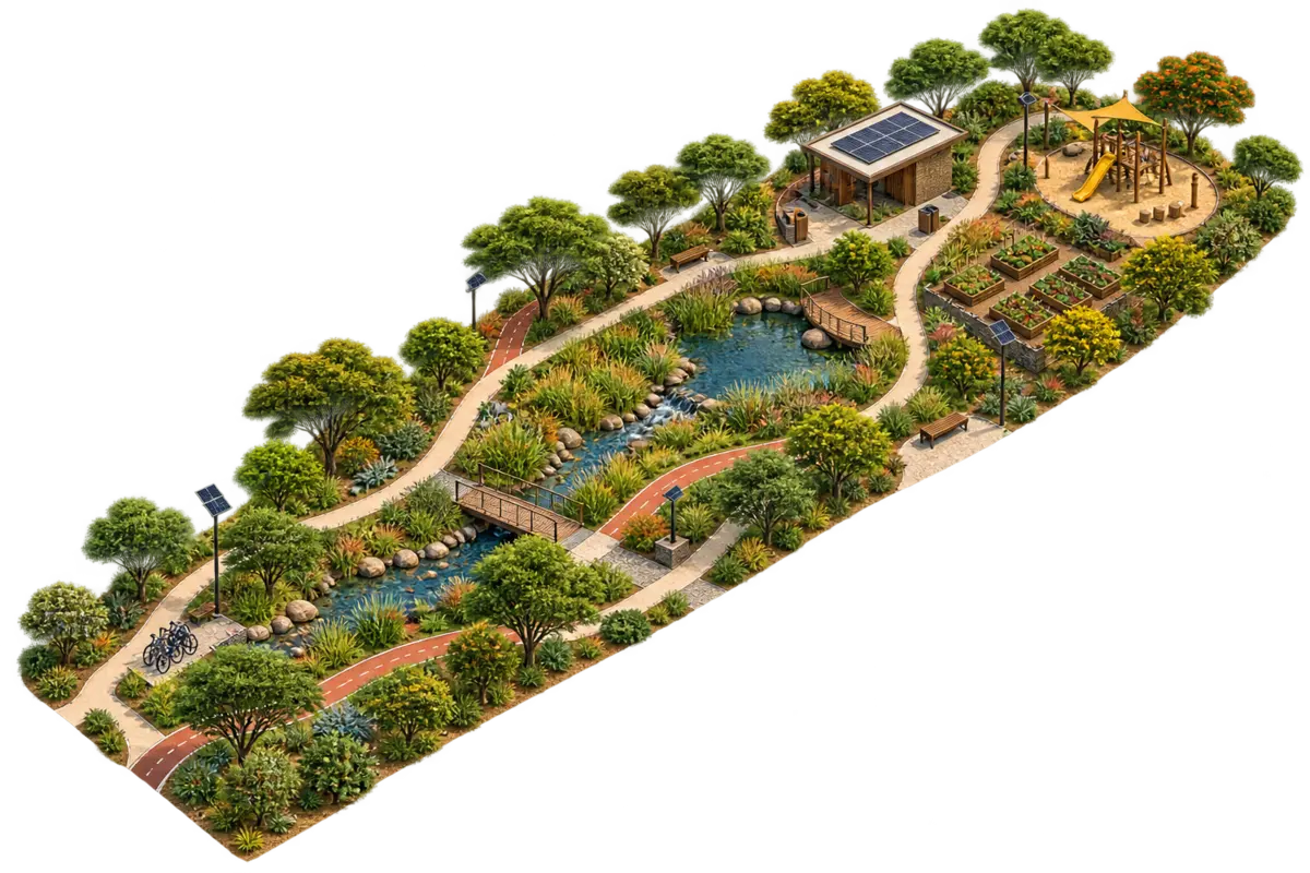
Illustrative green and water spine concept
☀ Renewable-ready◉ Water resilience↝ Green mobility♧ Landscape network
“The goal is not to decorate a map. It is to make a future city understandable.”
Evidence boundaryArchitecture, district names and lifestyle imagery are illustrative unless explicitly marked plan-derived or verified. This page is not a sales, cadastral, availability or construction-status document.

NOW ENTER THE DIGITAL TWIN

One city. Four useful scales.

The website story continues directly into the live spatial model. Start with the whole city, then move naturally through district, street and individual property context.
01CITYUnderstand the whole development
02DISTRICTRead neighbourhood character and anchors
03STREETSee frontage, movement and local context
04PROPERTYInspect one plan-anchored stand in context
Same evidence boundary throughout: concept architecture is illustrative; plan-derived geometry and recorded figures remain distinct from title, availability, pricing, servicing, approvals and delivery status.
CITY LEDGER / SOURCE-PLAN FIGURES

One drawing.
A whole life system.

The model turns technical land-use data into something people can navigate: home, school, work, public life, landscape and the infrastructure that holds everything together.

019,905planned stands & sites
029,580residential stands
03612.32hectares in total
0412primary & secondary school sites
0543.63hectares of active & passive open space
0621.91%of land allocated to roads
PLANNING SOURCE

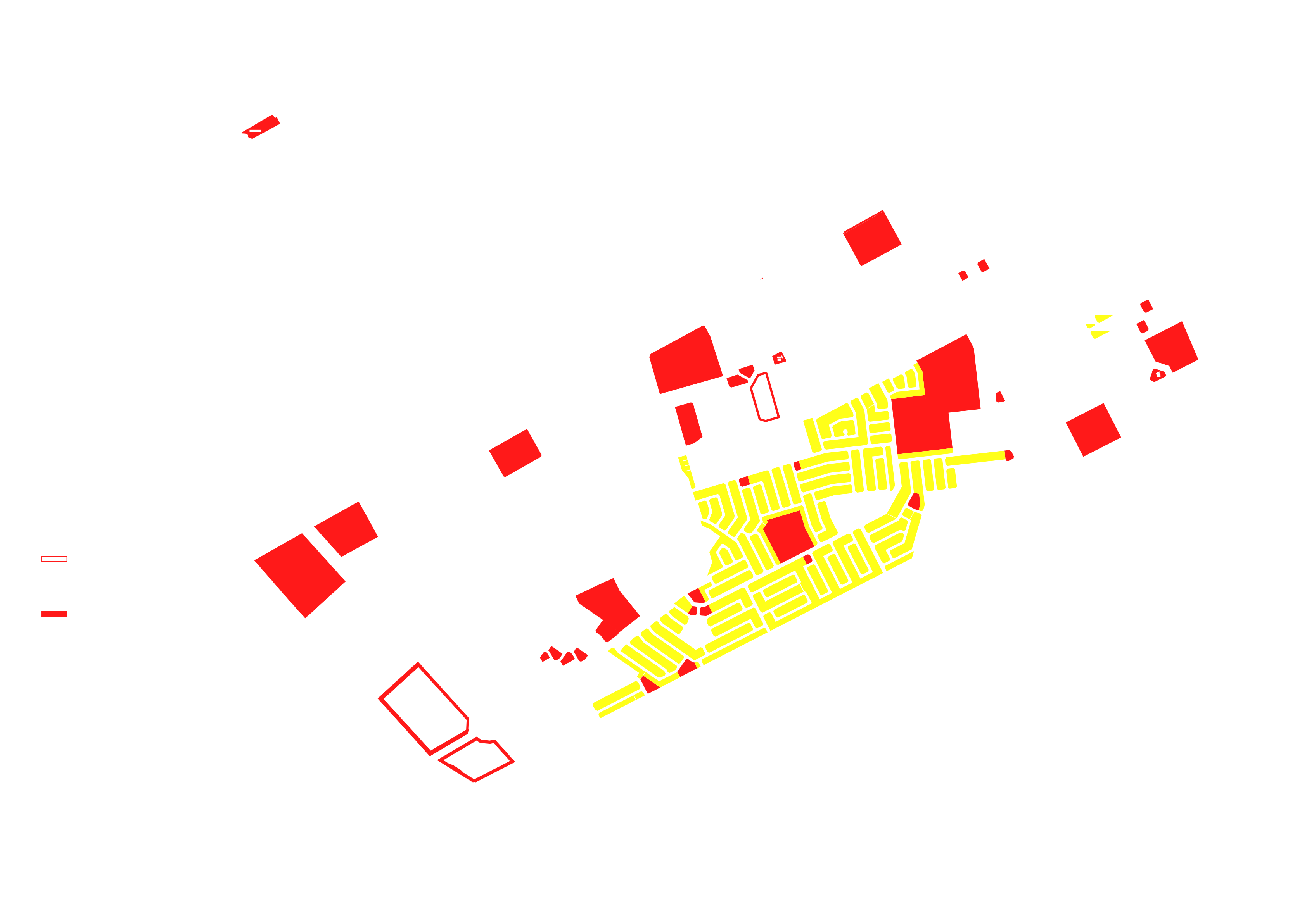
Based on the supplied “Proposed Amendment of a High Density Residential Layout on Dunnottar Farm” plan for Manyame R.D.C., scale 1:5000, dated July 2025.

Interpretive digital concept — not a cadastral, sales, availability or construction document.
DUNOTTAR INVESTOR MATERIALS / LIVE CAMPAIGN WALL

Sixty campaign ideas. One evidence base.

These are web-native variations of the investor campaign library: the same facts restaged as hero moments, sector propositions, compact cards and presentation-ready narratives.

PLAN-DERIVEDDIGITAL CONCEPTPROJECT-SIDE CLAIM · VERIFY
INVESTOR CAMPAIGN / WEB EDITION

One drawing. A whole city proposition.

Turn the current Dunottar plan ledger into a clear investment story without losing the evidence boundaries that make the proposition credible.

DUNOTTAR / MANYAME R.D.C.
612.32hectaresTotal plan area in the current ledger
9,905stands & sitesPlanned across the current ledger
9,580residentialResidential stands in the source-plan interpretation
58flat sitesA second housing layer
82commercialCommercial sites in the current interpretation
81industrialIndustrial sites plus service-industry land
47institutionalIncluding school, clinic and police provision
43.63ha open spaceActive and passive open space
612.32 ha

A city proposition, not simply a residential layout.

Homes, schools, civic uses, enterprise, landscape and city systems sit within one settlement framework.

9,905

9,905 planned stands and sites across one coordinated spatial system.

Use the total ledger to communicate scale, then break the story into housing, enterprise, civic uses, landscape and movement.

SLIDE / LEAFLET VARIATION9,905

Planned stands & sites

One number, one argument, one evidence status. Designed to travel cleanly from the website into presentation collateral.

PLAN-DERIVED
RESIDENTIAL STORY

Home is bigger than the stand number.

Pair housing scale with green streets, schools, civic life and everyday movement.

INVESTOR DILIGENCE

Evidence before hype.

  1. What is shown on the supplied plan?
  2. What is Mukoko.Studio interpreting?
  3. What must the project-side team still verify?
DUE DILIGENCE REQUIRED
CAMPAIGN SYSTEM

Use the website as the source presentation.

Each panel is intentionally structured so the same message can become a slide, factsheet, leaflet panel, exhibition graphic or phone-first investor card without changing the underlying evidence language.

Open city-systems diligence ↓
THE DUNOTTAR PROSPECTUS / VISION LABPLAN-DERIVED · CONCEPT INTERPRETATION · DUE DILIGENCE REQUIRED

A city proposition, not simply a residential layout.

The supplied plan brings homes, schools, civic uses, enterprise, landscape and city systems into one settlement framework. This digital prototype lets different participants examine that same plan from their own perspective—without turning an interpretive model into a sales, title or approval claim.

01 / YOUR ROUTE

What brings you to Dunottar?

INVESTOR / CAPITAL PARTNER

Understand the whole city before the capital question.

Read the plan as a connected system of residential, civic, enterprise, landscape and movement uses, then identify the project-side evidence still needed for an investable proposition.

USE THIS PROSPECTUS TO

Start with scale, mix, infrastructure questions and delivery governance.

02 / INVESTMENT CASE

Evidence before hype.

612.32HECTARES / TOTAL PLAN AREA IN THE CURRENT LEDGER
9,905PLANNED STANDS & SITES / CURRENT LEDGER
9,580RESIDENTIAL STANDS / CURRENT LEDGER
43.63HA ACTIVE & PASSIVE OPEN SPACE / CURRENT LEDGER
WHAT CREATES THE SPATIAL PROPOSITION

Residential scale is supported by civic, commercial, enterprise, landscape and movement uses in one plan. The opportunity is therefore not only the number of plots; it is the potential coordination of a whole urban system.

WHAT THIS PAGE DOES NOT ASSERT

Registered title structure, approvals, serviced-land status, infrastructure delivery, phasing, demand, commercial terms, governance, investment returns and developer appointments all require project-side evidence.

INVESTOR READINESS QUESTIONS
  1. 01What is the verified land, title and authority position?
  2. 02Which approvals exist, which remain outstanding, and what conditions attach to them?
  3. 03What infrastructure is funded, designed, phased and contractually allocated for delivery?
  4. 04What demand, product, pricing and absorption evidence supports each development phase?
  5. 05What governance or master-developer structure will coordinate land, infrastructure, design and long-term stewardship?
Explore the city before the investment case ↑
03 / DEVELOPMENT OPPORTUNITIES

Where a delivery partner could enter the city story.

These are plan-use opportunity families, not an availability schedule.

01
HOMES

Residential neighbourhoods

The largest land-use programme is housing, but value depends on how neighbourhood life, services and movement are delivered around it.

PLAN CONTEXT

9,580 residential stands are stated in the current source-plan interpretation.

See in city ↗
02
HOMES

Flats & higher-density living

A second housing form can broaden the residential mix and support more compact activity around central areas.

PLAN CONTEXT

58 sites are identified for flats in the current plan interpretation.

See in city ↗
03
ECONOMY

Commercial & neighbourhood trade

Local trade and a recognisable civic-commercial heart help turn a layout into a place with daily economic life.

PLAN CONTEXT

82 commercial sites are stated in the current plan interpretation.

See in city ↗
04
ECONOMY

Enterprise & employment

Employment uses at the eastern edge create a potential productive gateway while keeping heavier activity away from the residential core.

PLAN CONTEXT

81 industrial sites plus service-industry land are represented on the plan.

See in city ↗
05
COMMUNITY

Learning, health & civic uses

A city-scale population needs social infrastructure designed into the spatial framework from the start.

PLAN CONTEXT

The interpretation records 47 institutional sites, including 9 primary and 3 secondary school sites, plus clinic and police provision.

See in city ↗
06
GREEN

Landscape & public realm

Open space can become connective infrastructure: shade, recreation, identity and a legible landscape spine rather than leftover land.

PLAN CONTEXT

43.63 hectares are identified as active and passive open space.

See in city ↗
07
INFRASTRUCTURE

Mobility & city systems

The investment case ultimately depends on how movement and utilities move from plan-stated reservations into coordinated, funded delivery.

PLAN CONTEXT

The plan interpretation includes a railway-station site, a 31.5 m primary road corridor, a water reservoir and a bio-digester.

See in city ↗
04 / DEVELOPER JOURNEY

From interest to a diligence-ready conversation.

A PROPOSED ENGAGEMENT PATH / SUBJECT TO PROJECT-SIDE CONFIRMATION

  1. 01Identify a place

    Use the living city or a numbered stand to anchor the conversation spatially.

  2. 02Read the context

    Understand land use, nearby streets, civic destinations, landscape and city-system relationships.

  3. 03Define the role

    Set out the development concept, intended use, delivery capability and information needed.

  4. 04Verify the proposition

    Confirm title, authority, planning, infrastructure and commercial position with the actual project-side stakeholders.

  5. 05Enter formal diligence

    Move into an agreed technical, legal, commercial and delivery route. This Vision Lab does not itself allocate or approve land.

05 / CITY SYSTEMS

A readiness matrix that separates evidence from ambition.

01SHOWN / STATED ON SUPPLIED PLAN02DIGITAL / DESIGN INTERPRETATION03NEXT-STAGE VERIFICATION
Road network

01Primary and local road structure shown; 21.91% of land is allocated to roads in the current ledger.

02Street hierarchy, movement context and selected concept names are made navigable in the model.

03Surveyed alignments, detailed design, phasing, construction responsibility and funding.

Rail & regional movement

01Railway-station site reserved in the current interpretation.

02Rail gateway is used as a city-scale wayfinding destination.

03Operating proposition, interfaces, approvals, delivery programme and transport integration.

Water

01Water-reservoir provision appears in the current plan interpretation.

02Water and resilience are treated as a visible city-system layer.

03Source, capacity, treatment, reticulation, pressure, funding, phasing and operating responsibility.

Waste

01Bio-digester provision appears in the current plan interpretation.

02Waste is grouped with resilience infrastructure rather than hidden from the city story.

03Technology, capacity, approvals, collection model, network design and operator.

Drainage & stormwater

01No completed servicing claim is made here.

02Landscape and road relationships provide a surface for future drainage evidence.

03Hydrology, drainage strategy, flood risk, outfalls, easements, detailed levels and maintenance.

Power & energy

01No completed power-servicing claim is made here.

02Energy can be added as a governed evidence layer in the next-stage model.

03Supply capacity, network design, substations, renewable strategy, connections, phasing and operator.

Digital connectivity

01No verified telecoms delivery claim is made in this Vision Lab.

02The city prototype demonstrates the value of a shared digital place record.

03Fibre/mobile strategy, ducting, providers, coverage, smart-city scope and operating model.

Civic infrastructure

01Schools, clinic, police and other institutional sites are represented in the current plan interpretation.

02Civic destinations are connected to surrounding neighbourhood and street context.

03Operators, briefs, capacity, funding, delivery dates, approvals and service catchments.

Green network

0143.63 ha of active and passive open space is recorded in the current city ledger.

02A connected green-spine story is used to explain landscape as part of city structure.

03Landscape design, ecology, drainage role, ownership, maintenance, public access and phasing.
06 / CITY-MAKING FRAMEWORK

Principles for a well-made Dunottar.

PROPOSED DESIGN PRINCIPLES BY MUKOKO.STUDIO / NOT A STATUTORY DEVELOPMENT CODE

01

Build the street, not only the plot

Frontages, entrances, shade and active edges should make the public realm feel intentional at walking speed.

02

Connect the green structure

Open space should work as a linked landscape system for recreation, comfort, ecology and water resilience.

03

Design for climate before decoration

Orientation, shade, ventilation, roof form and durable materials should do useful environmental work.

04

Treat water as city infrastructure

Drainage, storage, servicing and landscape should be coordinated with roads and plots instead of resolved as separate leftovers.

05

Make everyday movement legible

Walking, servicing, public transport and vehicle movement should be safe to understand at city, neighbourhood and street scale.

06

Put daily life close to homes

Learning, health, community uses and neighbourhood trade should strengthen residential districts rather than sit as isolated compounds.

07

Coordinate utilities before occupation

Servicing corridors, access, maintenance and future capacity should be planned as one delivery system.

08

Protect long-term place character

Materials, signage, boundaries, landscape and public-realm standards should reinforce a coherent identity as individual sites are developed.

07 / THE CITY IN USE

Home. Daily life. Productive city.

HOME

A neighbourhood is more than its stand number.

The plan’s residential scale is read alongside schools, local civic uses, streets and open space so future home-builders can understand the wider place.

Explore neighbourhoods ↗
DAILY LIFE

Learning, health and public life belong inside the city.

The current interpretation records 47 institutional sites, including school, clinic and police provision, creating a civic layer that can be explored in relation to homes.

Explore civic life ↗
PRODUCTIVE CITY

Employment and trade need their own spatial logic.

Commercial and enterprise uses cluster around the civic heart and eastern edge, with a rail-gateway relationship that makes employment part of the city proposition.

Explore enterprise ↗
08 / EVIDENCE DESK

Use the model. Keep the claim boundary visible.

WHAT THIS VISION LAB CAN SHOW

Source-plan relationships, current plan-derived figures, extracted numbered labels, city-scale land-use context and an illustrative spatial/design interpretation.

WHAT IT CANNOT PROVE YET

Ownership, registered title, availability, price, approvals, servicing completion, implementation contracts, investment returns, delivery dates or official status of concept streets and buildings.

09 / COMMERCIAL TRANSPARENCY

Questions worth answering before the sales language begins.

01Can I buy or reserve a stand here?

No transaction, allocation or availability claim is made in this Vision Lab. It is an interpretive digital layer over the supplied plan.

02Are prices or investment returns shown?

No verified commercial schedule or return is asserted here. Commercial terms belong in project-side due diligence.

03Are the street names official?

No. Concept street names and their digital alignments are illustrative and are not surveyed or gazetted. The existing source-plan road-name caveat remains separate.

04Are the 3D buildings approved designs?

No. They are illustrative design concepts used to make land use, scale and city character easier to understand.

05What can I use this site for now?

Explore the plan, understand the city system, locate numbered stand labels, identify opportunity areas and assemble the questions that need evidence from the actual project-side stakeholders.

10 / NEXT VIEW

Choose your route into Dunottar.

Start with the reason you came, then return to the same city model with better questions.

Return to the living city ↑
PROJECT-SIDE PUBLISHED INFORMATION / LIVE SOURCE CHECKEXTERNAL CLAIMS · VERIFY BEFORE RELIANCE
11 / PUBLISHED EVIDENCE

What the project-side websites are saying now.

The Vision Lab keeps source-plan evidence separate from commercial and delivery claims. Public Leengate pages are useful due-diligence leads, but they currently contain conflicting status language, so this layer shows the claims and the conflict rather than silently treating either as settled fact.

01CURRENT LEENGATE PROJECT PAGE

Land-development proposition

  • Describes Dunottar, Chitungwiza as a high-density community development.
  • States a partnership with the Ministry of Local Government & Public Works.
  • States a location off Chitungwiza Road, approximately 26 km from the CBD.
  • States stand sizes from 280 m² to 1,200 m².
  • States stands are fully serviced with tarred roads, sewer and water reticulation.
Open current Leengate source ↗
02LEGACY / ALTERNATE LEENGATE WEB PROPERTY

Commercial information still published

  • Describes the project as “In Progress”.
  • Publishes 300 m² as an available size.
  • Publishes a price of US$55/m² and payment terms.
  • Repeats the serviced-stand and 280–1,200 m² range claims.
Open alternate Leengate source ↗
STATUS CONFLICT / DO NOT NORMALISE SILENTLY

One Leengate page says “Completed”; another says “In Progress”.

Until the project-side team confirms which status, inventory and commercial schedule is current, this Vision Lab should not convert those public statements into a definitive project status, availability register or price list. Investors and developers can use the links above as evidence leads and request dated confirmation.

QUESTIONS TO CLOSE WITH THE PROJECT-SIDE TEAM
  1. 01Which public project-status statement is current?
  2. 02Which stands or opportunity areas are genuinely available today?
  3. 03Is the published US$55/m² schedule still active, and for which product?
  4. 04What evidence supports the “fully serviced” claim by phase and location?
  5. 05Which ministry, council, developer and delivery responsibilities are formally documented?