WAVE 09 / STAKEHOLDER REVIEW

Make this exact spatial context decision-ready.

Carry the scheme, phase and selected record into one shareable review surface. No separate SaaS workspace; the review stays attached to place.
OPEN REVIEW MODE ↗
SCHEMEChiedza New City
PLACEWhole model
RECORDScheme-level selection
PHASEAll phases
SCALEEVIDENCE

WAVE 10 / EVIDENCE PROVENANCE

What this selection is — and is not.

A professional spatial model should make provenance visible before anyone mistakes a convincing interface for verified project evidence.
01 / SUPPLIED SOURCENOT ATTACHED

No client CAD, GIS, title plan, planning drawing or technical schedule is attached to this concept demonstrator.

02 / GENERATED GEOMETRYGENERATED

Scheme-level selection is generated from the Mukoko.Studio demo schema. It is not surveyed, as-built or a measured digital twin.

03 / INTERPRETATIONILLUSTRATIVE

Land use, district, phase and property labels demonstrate how project records can attach to place; they are not professional conclusions.

04 / UNRESOLVED ASSUMPTIONSOPEN

Planning, title, ownership, cost, programme, availability, engineering capacity and compliance remain unverified until evidence is supplied.

WAVES 11–12 / ACCOUNTABILITY + EVIDENCE LINEAGE

A decision surface with memory.

Chiedza New City · scheme level · PLANNING · ALL PHASES
CHECKING ACCESS
PUBLIC RULE

The spatial demonstrator remains explorable without an account. Persistent decisions and evidence files are private, authenticated and owner-scoped; this public surface cannot upload files or create project records.

01 / EVIDENCE STATESUPPLIEDOriginal drawing, schedule or dataset from the project team.
02 / EVIDENCE STATEINTERPRETEDGeometry, relationships or assumptions derived from those sources.
03 / EVIDENCE STATEILLUSTRATIVEDemo records used to prove interaction without presenting them as project truth.
04 / EVIDENCE STATECONNECTED / LIVEOnly used when an agreed source system is actually connected and governed.

WHAT MAKES THE CONTROL ROOM USEFUL

The spatial interface should orient decisions without pretending to be every source system.

  • OrientLocate the issue in the development, phase, building or property context.
  • FilterSwitch audience, planning, delivery, infrastructure, property or commercial layers.
  • TracePoint back to the agreed evidence or system of record behind a visible status.
  • ActGive the right team the next decision without exposing every internal detail to every user.
MK / SPATIAL DEVELOPMENT LAB
CONCEPT DEMONSTRATION / DEMO DATASTART A PROJECT ↗

DEVELOPER CONTROL ROOM / ONE MODEL, GOVERNED VIEWS
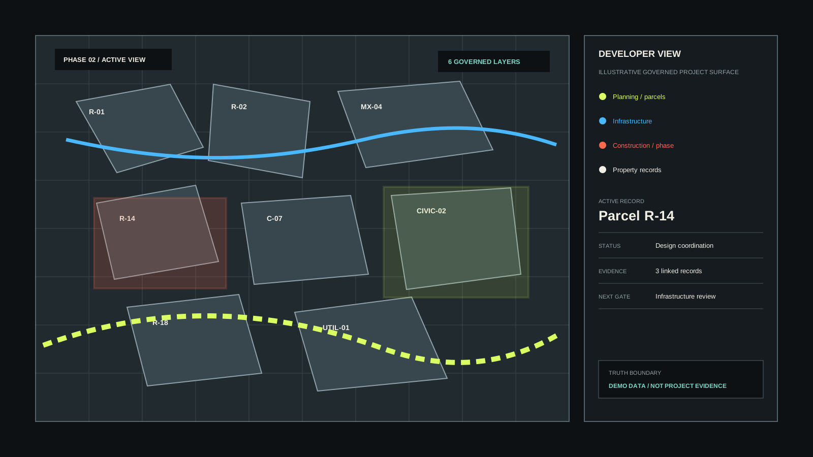
The model becomes a working project surface.

Use the same spatial system to communicate the scheme publicly, then switch into governed delivery, phasing, infrastructure and property information.
ACTIVE DEMO CONTEXTChiedza New CitySCHEME LEVELInfrastructure
Developer control room concept showing parcels, phases, infrastructure and governed project records
CONSTRUCTION LAYERDEVELOPER VIEW

THE COMMERCIAL POINT

A visual model can carry the project information teams already manage elsewhere.

PLANNING

Parcels, boundaries, approvals and evidence.

DELIVERY

Phases, dependencies, roads, utilities and programme.

PROPERTY

Buildings, units, availability and sales records.

COMMUNICATION

Public and investor views without exposing internal detail.